Farncombe Urban map
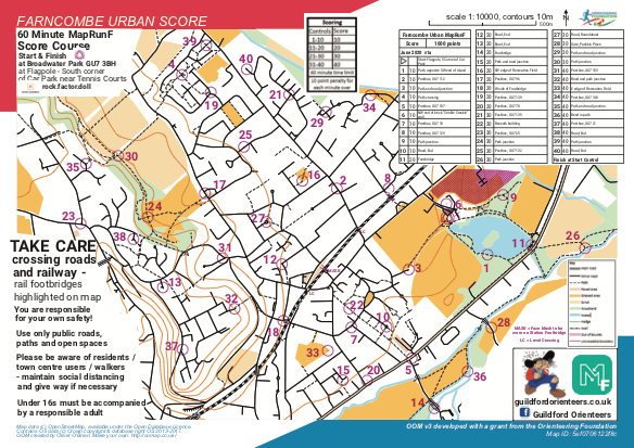
Farncombe Urban Score map
Information
Includes the pleasant Broadwater Park and the River Wey Navigation
Farncombe is bisected by a railway line and there are level crossings on either side of the station marked “LC” on the map. If the barriers are coming down please be patient and wait. To avoid the risk of undue delay, you could plan to use one of the 3 railway footbridges marked in purple on the map, of which one is at the station itself (see Safety Notes below).
Location
/-0.5964,51.1992,12/500x400?access_token=pk.eyJ1IjoicGF1bGZyb3N0IiwiYSI6ImNrb3gwYndwbDBhNjMyb3Q2cTAzajhzbjQifQ.s1B_G4dqnxOBH83Gv9EBmw)
Near: Godalming Lat,Lng: 51.1992,-0.5964 Postcode: GU7 3BJ What3Words: ///rock.factor.doll
Open an interactive map in: GoogleMaps - AppleMaps - OpenStreetMap - BingMap (OS 50k)